Ponies, Rain, Trail Magic
The last twelve days of trail has brought relatively easy terrain and amazing interactions with people around the trail. I exited Damascus on Saturday getting ahead of the "bubble" of hikers who would leave Sunday. This lead to the most quiet hiking I've been able to do since coming out here. The trail leaves Damascus roughly following the Virginia Creeper trail making for an easier exit than most towns. I wound up stopping at the first shelter for lunch and stayed for three hours as some afternoon storms rolled through. The storm cooled everything off and made for a wonderful late afternoon hike.
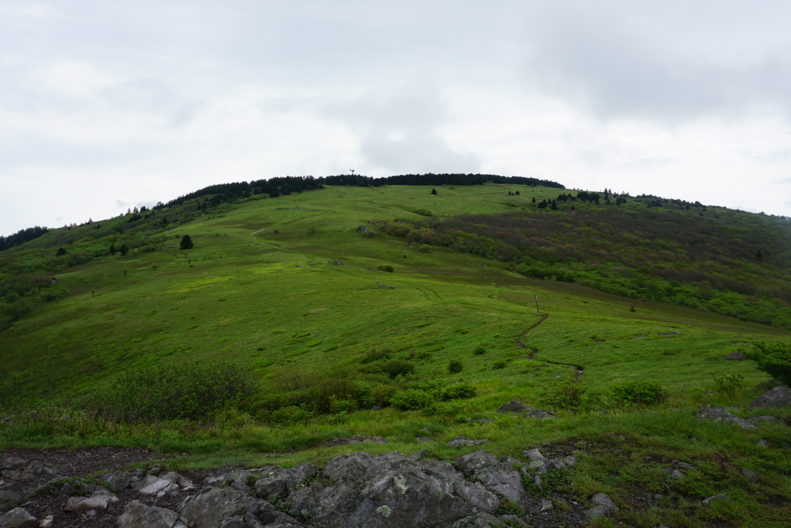
The next morning would dawn in a rain storm leading to a late start to the day. It stopped long enough for a dry pack out of camp and semi-dry start to the day of hiking. Today the trail would take me across Mt. Rodgers (highest point in Virginia) and through the gorgeous Grayson Highlands. The morning was simple enough with a long steady climb up to Mt. Rodgers via Whiterock Mountain.
Somewhere near the peak spitting rain slowly became steady and combined with wind and little to no tree cover the day became rather unpleasant. But I had a hotel reservation so I pushed on through trails that had become streams and ponds. Thankfully some ponies were out in the Highlands offering a bright spot in the rain. These ponies were introduced to control vegetation growth after the Highlands were closed to grazing by other livestock. It is a small mostly wild herd that wanders about and provides a unique experience for hikers.
Due to confusing trail junctions and a major discrepancy between my guidebook and state park trail signs I missed my turn to Massie Gap and my hotel room. This would set in motion the first trail magic of this set of miles. After getting turned about and down to the road I had just enough cell service to get my shuttle in to Grayson Highlands Motel. This small general store/restaurant/motel is run by two brothers. After getting me from the trail they got me my room and despite having been closed for almost an hour made me a hot meal while I got cleaned up. Their graciousness would not stop until I left the next day. People like these are the real heart of this experience and show why people refer to the trail as a community. This would also begin a six day stretch where I would see this almost daily.
The next day cleared out and made for a pleasant afternoon oh hiking through the Highlands. The trails were soaked but the rain would hold off until the evening. Rain is not the worst when you can relax in your tent and just enjoy it.
The next day would again be rain free in the morning however, the afternoon would contain periods of rain. The morning was foggy and made for gorgeous woods walking through open fern carpeted woods.
This day would take the trail through the Great Appalachian Valley which separates the Blue Ridge mountain province from the Ridge and Valley province. This took the trail through narrow corridors of private easements as it jumped from one national forest to another. Camp that night was at the end of the open pastures and tucked into a house of rhododendrons that provided welcome shelter from more rain.
The next day was a short one stopping at the Quarter Way Inn. While this was a hostel it felt more like a home. We passed the afternoon watching the last bout of rain lash the surrounding fields while we were warm and dry. Tina (aka Chunky) was a gracious host who on top of giving us a home, served everyone an amazing homemade breakfast. This breakfast was above and beyond what anyone would expect and was a welcome reprieve from trail food.
The next day would take the trail out of the Great Valley and into the Ridge and Valley. Here the trail changed character greatly being more defined by slow climbs to ridges and then rambling along narrow, mostly flat ridge tops. After the rain the sunny day and clean, dry gear made for a good day of hiking.
The day would on Chestnut Knob a beautiful open ridgeline. From camp I could see south to four or five peaks of crossed over the past weeks. It afforded a view all the way back to Roan High Knob. This view offered the really unique opportunity of seeing just how far I've actually hiked in the real world. Generally my progress is measured in turning of guidebook pages.
The next day would start a two day stretch of incredible trail magic. Trail Magic is generally a cooler of soda or some snacks near a road crossing. However, being a holiday weekend numerous groups and former thru hikers were out and about. Over the course of two days I was served hot dogs, burgers and countless sides snacks and sweets. Almost all of them had beers for hikers (thru hikers know what thru hikers want), one group even brought a full keg of New Belgium IPA. All of this because the thru hikers wanted to give back to the trail that provided them so much when they hiked. This made for great fun, but maybe not the most productive hiking days.
Somewhere in here I crossed the 600 mile mark. Each milestone is a great feeling and leads to confusing mix of feelings between accomplishment and realizing how far there is to go yet. But mostly it's a great feeling to really "see" the progress.
The next few days offered pretty but uneventful trail as I rolled north to Pearisburg. The trail was defined by many stretches of green tunnel interspersed with lots of blooming rhododendron and flame azalea. The trail is still beautiful but in a much more subtle way.
My last camp would provide a unique experience involving barred owls. Just before dusk the usual calls of "who cooks for you?" began. Not long after they became closer and I soon realized I had five barred owls surrounding my camp. For at least a half hour the owls worked their way down the ridgeline calling the whole time. At one point they were almost directly overhead. I've never had this many owls calling so closely and it will be a long lasting memory.
From here it was a nice stroll down in to Pearisburg and a day in town to recoup, run some errands and generally enjoy a day of being lazy.


